Lately I haven't been doing much other than continuing to find ways to save my cash and be on the lookout for boats. I've searched around marinas in Cape Canaveral, Titusville, Green Cove Springs and St. Augustine. I've found a few for sale, but nothing really stand-out. If the motivation hits me, I'll post some pix and review some of the boats I saw. But going out and just seeing the boats docked and on the hard has helped me visualize a lot of the things I read about in my studies. It is a lot of fun and I'll continue to explore marinas.
Hopefully over the course of this blog you will get to know me a bit more as a person. As someone who has obvious adventure lust, I do many other things to keep myself occupied and entertained aside from surfing and sailing. One of my many hobbies is backpacking. Before I go further, let me clarify....when I mention backpacking to most people, they seem to visualize someone hauling a backpack through trains and hostels in Europe. Not so my friend...I am talking about backwoods, primitive camping type backpacking. Where you hike many miles carrying your food, water, clothes, cooking supplies and everything you need to survive out there. It is a great thrill to hike deep into the wilderness, find a pristine site to post up camp, have a relaxing evening, and then pack up in the morning to keep hiking.
Backpacking is something I anticipate doing while on my cruise. With my gear and knowledge, I should have a cheap and easy way to explore land wherever I happen to be. Hiking around an island and camping on a secluded beach with a perfect surf break out front....oh yeah.
This previous weekend I went to hike the north loop of the Richloam tract in the Withlacoochee State Forest. Here is the description of the trail from the Florida Trail Association:
The Richloam Tract of Withlacoochee State Forest offers a wide variety of plant and animal life. Of interest here is a state owned herd of longhorn cattle descended from the original Spanish cows, and one of the state’s top fish hatcheries.Follow the perimeter trail for a 25.6-mile weekend backpacking loop, or take a long day hike using the cross trails, which enable you to configure loops of 10, 12, and 14 miles. The trail passes through cypress floodplains, bayheads, pine-palmetto flatlands, hardwood hammocks and open pine prairies. Ancient live oaks shade the trail in places. There is also a relict experimental eucalyptus plantation from the 1930's that the loop trail passes through. Wildflowers are abundant from March until November.
The trail borders the Withlacoochee River in the southwest and the Little Withlacoochee River in the northern section and crosses numerous streams which drain the tract. Eagles, deer, turkeys, and other wildlife inhabit the area. Fishing is good here.
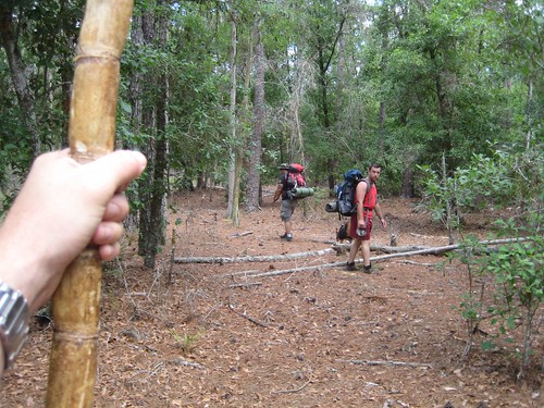
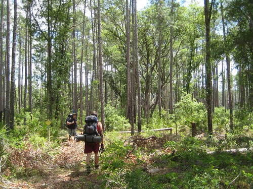
I figured this trail would be a good overnighter, have plenty of water, and give us something to do when we hit camp (fish). We (me, 2 buddies and a dog) hit the trail Saturday morning and started off at a the Richloam fire tower. The thing was locked, but that didn't stop me from climbing it. The stair well was rotting away making it a very nervy climb and the tower swayed this way and that. But I kept going until I got to the top only to find the last flight locked from passage. Below are pictures from the trailhead
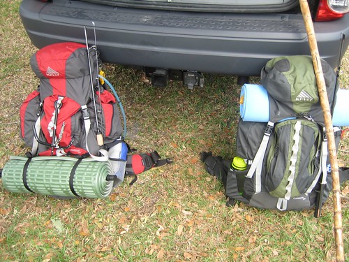
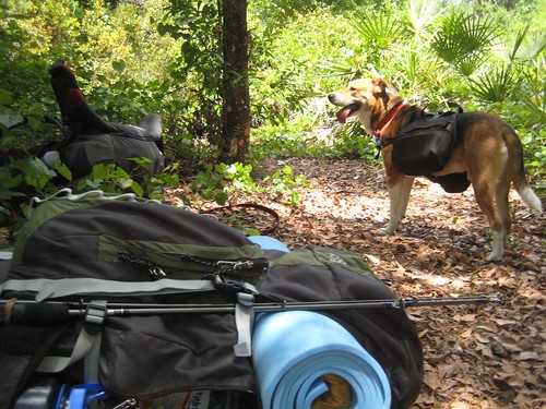
Gear ready to go:

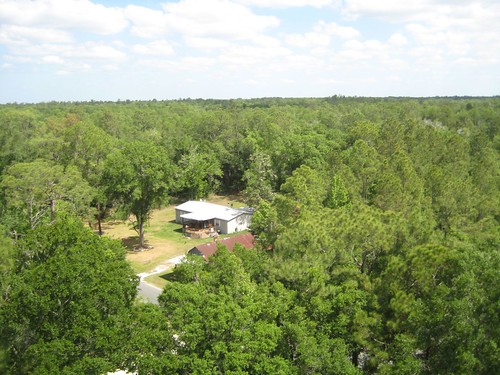
View from the top of the tower:
View from the bottom:

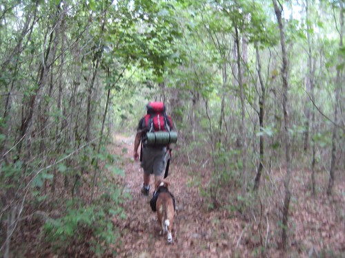
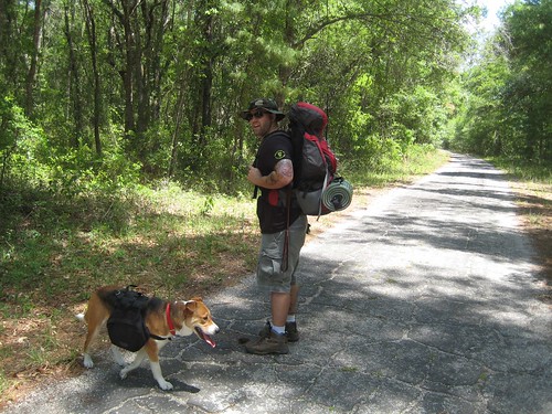
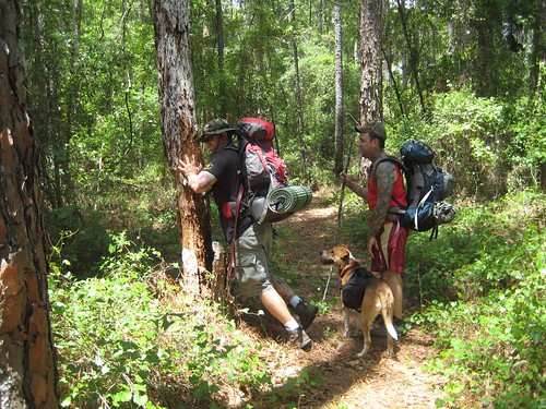
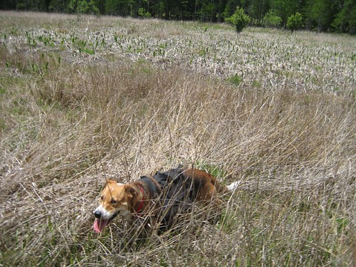
We filled up our water bottles at the tower and started the hike! Our first objective was to take some connector trails to the outer edge of the loop. The hike started off in dense forest and made for great shade and scenery. Otis (the dog) loved being out there and was a joy to watch. He even had his own saddle bags to carry gear.

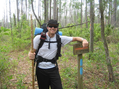
I had a sugar cane that I dried out about a year ago to use as a hiking stick. It was extremely light, had some flex to it yet was sturdy enough for a hiking pole. Unfortunately at the end of the day, I had to use it to avoid falling down a hole and it bent under my weight.
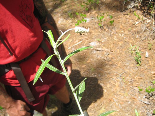
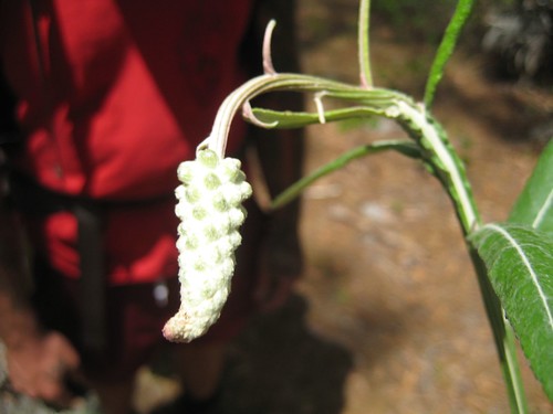
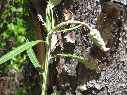
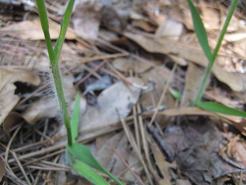
We saw some interesting plants, if you can identify any of the flowers and plants I have pictures of, please leave a comment! We took pictures to figure out what we saw. This one had a very strange stem that fanned out onto four corners, almost like the stem itself was a leaf.
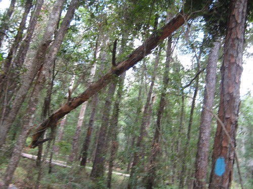
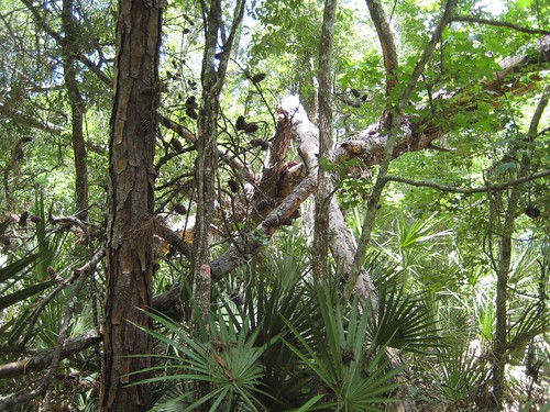
There were many fallen trees suspended in the air by other trees. Very neat to walk through them.
Here I am as we reached the outer loop from the connector trails. From here we had about 6 miles to go to the area we had planned on camping. Near the campsite is supposedly lakes and the Little Withlacoochee River to do some fishing and get water from.
Some other plant we found that was possibly edible from what we remembered
Here we are crossing Old Hwy 50. We travel the current Hwy 50 so much, this was a bit historical :)
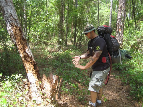
Found some standing dead trees and decided to do the right thing and push them!
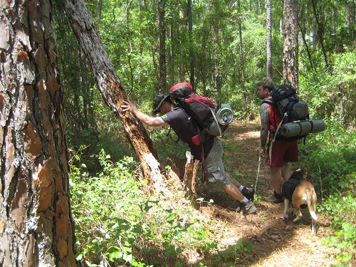
More suspended trees:
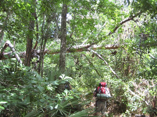
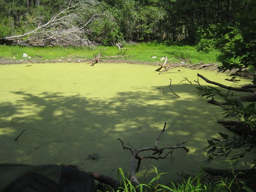
After a few miles of walking, I began to notice how dry the area was for supposedly the "wettest" hike of the area. All of the cypress swamps were bone dry, and then we came across what looked like where a pond should be...completely dry. We had a look around:
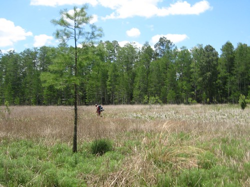
We then came across the portion of the trail that runs along the Little Withlacoochee River. We didn't realize we were on the river, because there was no river there. Only a dried up river bed. Immediately I started to get anxious about the water situation. We only had enough water to hydrate us on the hike to camp and we had anticipated on purifying water from the ponds and river. The map showed a couple of bigger lakes and even a sink hole by the camp so hope remained. The sink hole "Blue Sink" came to us first. It was off a small side trail and when we came to it, we were disappointed to find it so low and murky looking. At least we had found a water source if nothing else showed up. Unfortunately, every animal in the region probably used it for water as well.
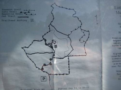
From here the camp site was supposed to be less than a mile. We hiked a little bit and noticed all of the ponds were dried up, confirming the dire water situation. We hiked until we reached a dirt road that the map showed as beyond the camping area, but we didn't want to back track. The map showed a large lake and a sectioned off "day recreation area" to the north, and the dirt road we were on would take us there in under a mile. We hiked up to it and found an information kiosk with a hand drawn map of the area. The map looked like it had a big lake in the middle of it and one of the trails was even named "lake trail", so we decided to give it a shot. About 30 yards in, I thought to myself "man, I should have taken a picture of the trail map", but instead of turning around and doing so, I decided to trust my brain. This would have been fine if we had not already hiked 8 miles and were ready to collapse.
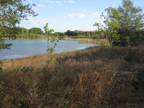
We missed our side trial to the lake and ended up hiking about 2 miles in this recreation area until we reached the boundary at a railroad track. We used the compass to orient ourselves towards the lake and kept going grudgingly. About 15 minutes later, spirits diminishing and coming to the conclusion that we had to backtrack all the way to Blue Sink, we finally reached the lake. And sure enough, it was bone dry...

We were all completely defeated at this point. There was absolutely no water in the area except Blue S(t)ink, and we had to backtrack to get there. We sat down in defeat to rest for a bit, just staring at the dry lake wondering how this could happen to us, when one of us looked around the corner and shouted "water!!!"
Turns out only half of the lake was dry, and right around a bend was a full side of the lake! The water was super low, but there was plenty of it:
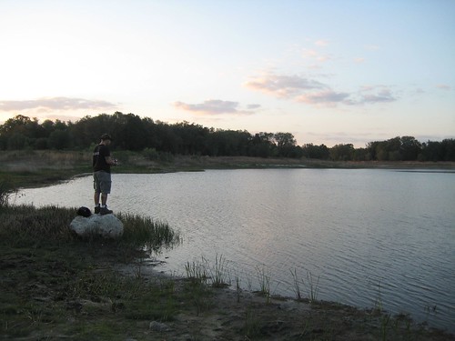
We were extremely relieved and excited. We dropped our packs and explored around the lake for the best spot to camp. While walking around we noticed a ton of good sized fish in the lake, and I couldn't wait to throw out a line. Eventually we set up camp on the west side of the lake, which had a steep incline to stop gators from creeping up on us. It turned out to be an absolutely beautiful camp site.

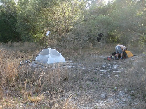

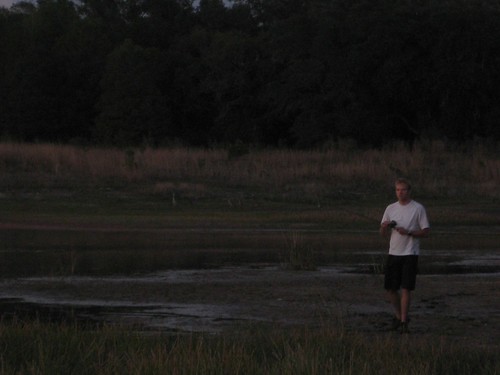
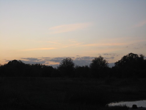
After setting up camp and resting a bit, we pumped water into our bottles and fired up dinner. I packed up a small bag full of my dinner, water and fishing gear to enjoy lakeside. I found a spot that looked like it had a lot of fish and enjoyed the sunset with a line out and dinner in my mouth. Everyone else came down eventually, Otis was chained at camp to keep guard. As the sun was setting we noticed many gator heads poking out of the water, so we knew we weren't alone. Some Sandhill Cranes were gathering on the banks as well coming in 2 at a time from the air. As the pairs would float down, the others would call out to them with a shriek. You can see them in the background:

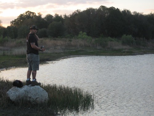

We only had cheap lures and weren't catching anything, but did have a few tugs. We found another lake with even more fish around the bend, giving us a laugh at the abundance of water where we thought we would have none! We fished in the dark for a bit at the new lake until we gave up and decided to hit the sack.
After sleeping soundly for a few hours, I was woken up by a terrifying shriek. It sounded like a crazy lady making a very long scream, until a chorus of screams answered the first one. It sounded otherwordly and sent shivers down my spine. Then as all of the screams let up, they started barking clueing us in that they were wild dogs. These things were definitely close, most likely down by the water. They wouldn't constantly howl, but it would happen every hour or so after I would dose off, just to wake me up again. It is difficult to describe the sound they made, but it was very spooky. We had Otis as protection, but I feared a pack of wild dogs would overwhelm him if we went to explore.
Since I was scared awake, I started to hear gators in the water splashing around while hunting, and many other critters in the woods behind us. About 2 hours before sunrise Otis began to bark a lot at something that was getting uncomfortably close. Sleep was an afterthought at this point, I just held close to my big knife, and was ready to pounce on whatever beast came into our camp alongside Otis. It was definitely the spookiest night of camping I have ever had. It may not be a good idea to camp at one of the only watering holes in many many square miles, too many animals lurking at night.
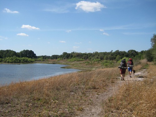
The morning was pleasant, but we were all sore and I lacked sleep. We had an 8 mile hike around the rest of the trial loop to do in the heat of the day. And as luck would have it, both of our water purifiers failed at the same time, leaving us with only a few bottles of water (I was the odd man out with practically none). How ironic that our water pumps would fail after we went through so much just to find the water source. But we kept positive and figured that we had enough water to finish the hike.
On we go!
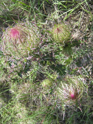
Here are some gnarly looking flowers that caught our eye:
We reached the entrance to the area we camped in, and found that map I should have taken a picture of. So, I did so. Even though it was too late, it was a funny memory to keep.
The rest of the hike was much like the previous day, but a bit hotter. We rationed our water and took it easy for most of the way. Stopping a few times for a snack and a breather. My feet were beginning to feel very sore, and I had a tight muscle behind my left knee bothering me. These are all relics of playing soccer all week, I definitely made a mental note to take it easy before I do these hikes.
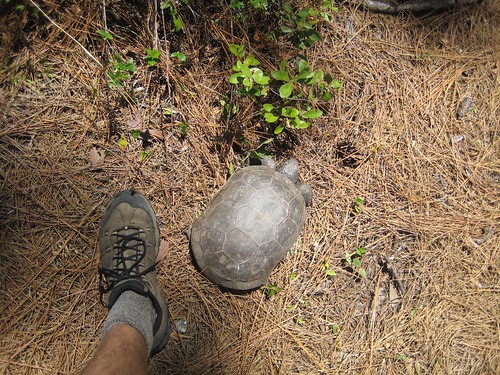
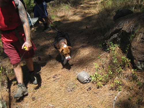
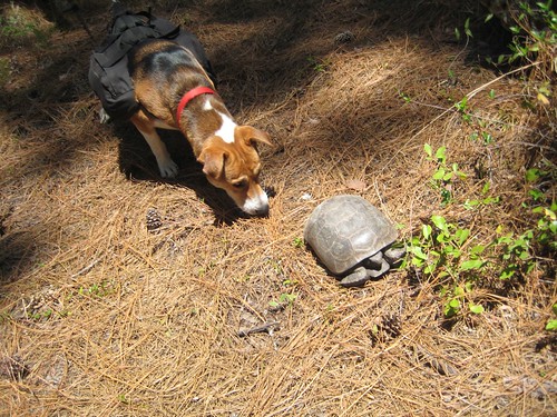
Near the end of the trail we ran into a tortoise!
We reached the end of the hike shortly after and packed up to go home. All in all, a great trip with a few problems, nothing catastrophic though. My estimate is that we hiked 18 miles total. It should have been about 15-16, but all of the extra hiking in the day use area upped our total. I would like to check this area out after the rainy season to see how different it is.

Thanks for reading!


3 comments:
lake beasts
Good times for sure. I should have a filter before our next one, and I dont think all 3 will break :)
Otis slept for the whole next day and was CLEARLY sore, but loved it.
I've done quite a bit of hiking up this way, but no backpacking yet. We have some amazing trails to go on, but acquiring the resources to do it is more than I can handle right now.
But if you ever wanted to come up and backpack the enchantments, the olympic mountains, or the pacific trail, i think i'd do what i could to get everything and go :)
Post a Comment